22 km


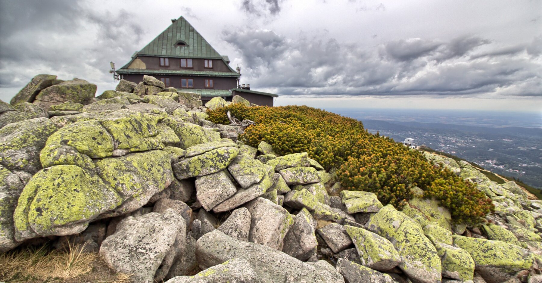
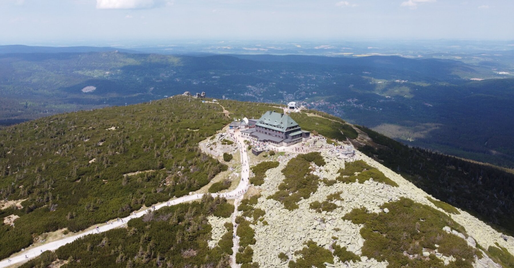
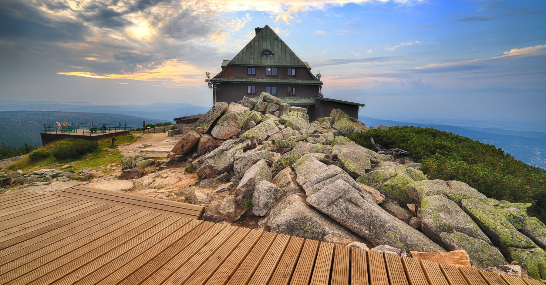
The Szrenica shelter is located on the top of the mountain of the same name (1,362 m above sea level), in the Karkonosze National Park, on the main Karkonosze tourist trail (red), 300 m from the border (15 minutes to the former tourist border crossing with the Czech Republic). It is an ideal base for trips and tourists on both the Polish and Czech sides. From Szrenica you can continue the route to Śnieżne Kotły.
Important information
Read more
Elements Hotel & Spa
Check out the most frequently asked questions
Other attractions

Animations for children
Every weekend and in selected stay packages for winter holidays, holidays and long weekends, animations and educational workshops are organized. Every child deserves great enter...
Activities 
Wellness zone
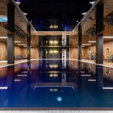
Take advantage of unique moments of relaxation in our water zone - Aqua Ignis. Unlimited access to the pool and sauna complex will guarantee you relaxation and our youngest gues...
Activities 
Indoor playground
At Elements Hotel & SPA, we care about the comfort and joy of the whole family! That is why we invite our youngest guests to the Monkey Grove - a unique play area full of jo...
Activities 
Bicycle tours
For our Guests, we organize guided bike tours along the charming trails of the Izerskie Mountains. This is a great option for those who enjoy active recreation and want to explo...
Activities 
Observation terrace
On the top floor of Elements Hotel & SPA, a viewing terrace with a breathtaking view awaits you.From this height, there is a picturesque view of the Izera Mountains and Świe...
Activities 
Fitness and Yoga Classes
Fitness classes at our hotel offer a comprehensive approach to health and well-being, including various forms of activity tailored to different needs. In our offer you will find...
Activities 
Bicycle rental
Our hotel's bike rental is an excellent solution for all lovers of active rest. Discover the local attractions and beautiful landscapes in a convenient and eco-friendly way. Whe...
Activities 
Sensus SPA
Sensus Spa is a world of the senses. Smell, sound and touch.Sensus Spa is a place for people looking for relaxation, lovers of beauty and top-class cosmetics.
Activities 
Play Room
Play Room is a place created with our youngest guests in mind. The room full of creative blocks and toys, will take every child to the world of imagination and great fun. It's a...
Activities 
Playground
Our playground is a place created for outdoor play! For our youngest guests, we have prepared swings, slides, soft sand and other toys that will ensure a great time for all adve...
Activities 
Campus - Games room
Campus is a place designed for our youngest Guests, as well as those slightly older. It is equipped with TVs and consoles with a wide selection of games. This is where everyone ...
Activities 
Game Zone
Game Zone is a recreational space available to hotel guests, designed to provide entertainment for every age group. Have a great time playing your favorite console games, invite...
Activities 
Forum Bar
The forum is a place of spontaneous meetings.The forum is a bustle of social and business talks. It's the smell of coffee, a quick snack or an evening drink.Forum is a climate, ...
Activities 
Gym - Colloseum
Colloseum Gym for those who like to start the day with a solid dose of exercise or end it with an active reset. Colloseum is an intimate but fully equipped hotel gym, where you ...
Activities 
Observation Tower on Młynica
This is a modern steel structure with a height of 33.8 m, featuring two viewing terraces: a lower one at 15.5 m and a higher one at 23.7 m. The top is reached by 148 metal steps...
Attractions in the area 
Observation tower on Czerniawska Kopa
The observation tower on Czerniawska Kopa stands in the western part of the Izera Mountains, on a peak located about 776 meters above sea level, in the Czerniawa-Zdrój area, whi...
Attractions in the area 
360° SKI&SUN View Terrace
On the roof of the upper station of the Ski&Sun gondola lift in Świeradów-Zdrój, at an altitude of 1060 m above sea level, a unique viewing terrace was created, from which y...
Attractions in the area 
LUMINA - Immersion and Entertainment
Every step takes you into a world full of colors, sounds, and surprising experiences.It is a modern space where technology meets art, creating entertainment that captivates comp...
Attractions in the area .jpg?updated=2026-07-23_18-12)
Sky Walk Observation Tower
The Sky Walk observation tower was designed by Czech professor Zdeněk Fránek. To ensure access for the largest possible number of visitors, the tower is located above the town, ...
Attractions in the area 
Smrek Observation Tower
The tower on Smrek is located just a few hundred meters from the Polish border and less than 3 km from the Na Stogu Izerskim hostel. It is open all year round, and entry to the ...
Attractions in the area .jpg?updated=2026-07-23_18-12)
The Black Mill
To this day, you can admire the original equipment of the mill, renovated in 2011-2012. It allowed the launching of a replica of the water wheel and adapting the buildings for t...
Attractions in the area 
Kamieńczyk Waterfall
A distinctive feature of the Kamieńczyk Waterfall is that it consists of three cascades with a total height of 27 meters. The Kamieńczyk Gorge itself is 100m long. The waterfall...
Attractions in the area 
Geopark - St. John's Mine.
Geopark is an open hiking trail, an unusual attraction of the Jizera Mountains. The first point is located in the village of Krobica. The St. John Mine is a 350m underground rou...
Attractions in the area 
Izera Dark Sky Park
Izerski Park of the Dark Sky - the first park of this type in PolandExplore one of the darkest corners of our planet. This is a place where light pollution does not reach, where...
Attractions in the area 
Glassworks and Krystalium "Julia" in Piechowice
The operating Julia Crystal Gass Manufacture is a unique point on the map of the Karkonosze Mountains – a combination of history, the beauty of glass masterpieces and true craft...
Attractions in the area 
Spa House with a Walking Hall
The building, built in 1899, was designed by a well-known architect named Grosser. The Spa House in Świeradów-Zdrój is divided into two buildings, which are connected by the lon...
Attractions in the area 
Ski&Sun Coaster
The alpine slide is 720 meters long and is a great attraction for the whole family. Each ride is a guarantee of unforgettable impressions and boundless joy.
Attractions in the area 
Single Track
Single Track bike trails are divided into four difficulty levels: very easy, easy, medium, and difficult - each is assigned a color. The easiest loop is two-way, while the more ...
Attractions in the area 
Ski&Sun Gondola Lift
A fast and modern gondola lift leads to Stóg Izerski. On the route, you can admire the panorama of the Jizera Mountains. The spacious gondolas are designed to transport both ski...
Attractions in the area 
Run Track
Run Track is a proposal for people who enjoy running in the mountains, outdoor activity, and relaxation close to nature. The routes work well for both shorter training sessions ...
Attractions in the area 
Mini golf course
The Minogolf course is a great pastime that trains dexterity and accuracy. A specially prepared 18-hole golf course is located at the intersection of Zakopiańska and Krótka Stre...
Attractions in the area .jpg?updated=2026-07-23_18-12)
Nature and Education Center | Sobieszów Palace
Nature and Education Centre of the Karkonosze National Park Sobieszów Palace.The Sobieszów Palace dates back to the early 18th century. Once, the palace was home to the Schaffgo...
Attractions in the area 
Querion – Hypermedia Entertainment Park
Querion is a hypermedia entertainment park with ten attractions where image, movement, and multisensory effects come together into one experience. From flying in the Flying Thea...
Attractions in the area 
Izerskie Alpaki
Izerskie Alpacas is a place created from love and passion for animals, mountains, and nature. We are a small alpaca oasis in the Izerskie Mountains, on the trail to Sępia Góra, ...
Attractions in the area 
Mała Japonia - Japanese Garden SIRUWIA
In the picturesque village of Przesieka, at the foot of the Karkonosze Mountains, there is Little Japan – the SIRUWIA Japanese Garden.It is one of the most extraordinary tourist...
Tours 
Jizera Mountains
The Jizera Mountains, owing to their relatively gentle slopes, are ideal for family mountain trips. They are also popular among mountain bikers. In winter, classic skiers flock ...
Tours 
Na Stogu Izerskim Hostel
The facility offers 50 beds, in rooms accomodating from two to ten people and of different standards. The hostel is famous for its cuisine - two buffets serve traditional Polish...
Tours 
Czocha Castle
Nowadays, apart from the museum, the castle houses a hotel (with real secret passages), a café, and a restaurant. Knights duels, chamber music concerts, and bonfire feasts take ...
Tours 
Mountain hut
Tourist shelter located on Hala Izerska in the Jizera Mountains. The village of Gross-Iser once existed on this pasture, and the only remnants of it are the shelter building and...
Tours 
Wysoki Kamień
Wysoki Kamień - one of the most beautiful places in the Sudetes. There is a view of the Karkonosze Mountains, the Kaczawskie Mountains, Rudawy Janowickie, the Jizera Mountains a...
Tours 
Śnieżne Kotły
Śnieżne Kotły is an excellent viewing point with a panoramic view of the Karkonosze Mountains, the Jizera Mountains, the Kaczawskie Mountains, the Rudawy Janowickie Mountains an...
Tours 
Quartz mine "Stanisław"
The highest located quarry in Poland, the "Stanisław" quartz mine in Szklarska Poręba - an open-pit mine at an altitude of 1,050 m above sea level.It is worth visiting the Stani...
Tours 
Shelter Tourist Station "Orle"
Orle Tourist Station is located in the heart of the Jizera Mountains. It was created on the basis of buildings that were the remains of the Carlsthal glassworks. Both in winter ...
Tours 
Karpacz
Karpacz, located at the foot of the Karkonosze Mountains, one of the most visited mountain resorts in Poland. It is a place where nature meets history and culture, creating a un...
Tours #elements_swieradow

MOUNTAIN RESORTS